The Appalachian Trail winds through 14 diverse states, traversing a range of landscapes and showcasing the natural beauty of the eastern United States. Discover the offerings of each Appalachian Trail state, from the rolling hills of Georgia to the rugged terrain of Maine. Whether you’re planning a thru hike or a section hike, these states offer an array of outdoor experiences for hikers of all levels.
The Appalachian Trail goes through these states: Georgia, North Carolina, Tennessee, Virginia, West Virginia, Maryland, Pennsylvania, New Jersey, New York, Connecticut, Massachusetts, Vermont, New Hampshire, and Maine.
Each of these states have a unique section of the trail, new experiences, and a host of trail clubs who support them. Here’s a state-by-state guide to the 14 Appalachian Trail states.
Georgia

Miles: 78 miles
Elevation: 2510′ – 4461′
Trail clubs: Georgia Appalachian Trail Club
- If you’re starting a thru hike going NOBO (northbound), this will be your most crowded state. Between 3,000 to 4,000 people attempt a thru hike of the AT every year, and the majority of them start here in Georgia.
- Stop by the basecamp at Amicalola Falls to get your hang tag and a chance to talk to the rangers about current conditions on the trail.
- Neel’s Gap (and the Mountain Crossing store there) is your first major milestone. Get some pizza, restock, and if you discovered that you forgot some gear or that you’d like to send gear home, you can do so there.
- One of my favorite hostels, Hidden Pond, is located in this state!
- If you’re looking for a shuttle to help you get to the trail, try Bandit (aka, Dale Johnson) with Mountain Trail Shuttles.
North Carolina

Miles: 96 miles fully in state; 217 miles along NC/TN border
Elevation: 1725′ – 5498′
Trail clubs: Carolina Mountain Club | Hot Springs Mountain Club | Nantahala Hiking Club | Smoky Mountain Hiking Club
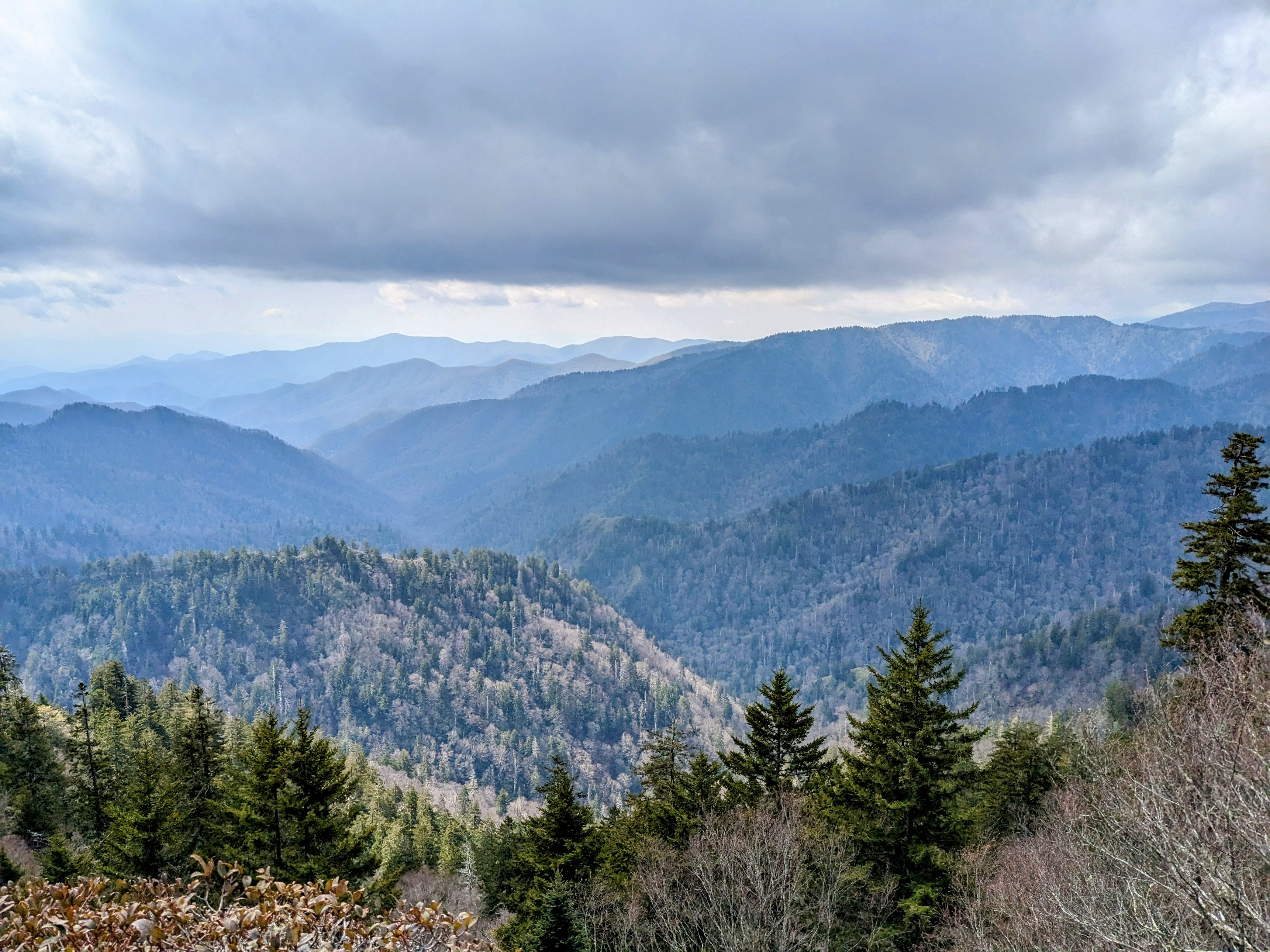
- You’ll be bouncing back and forth between North Carolina and Tennessee, especially going through the Great Smoky National Park.
- The Smokies requires a permit; make sure you have one!
Tennessee

Miles: 74.4 miles fully in state; 217 miles along the NC/TN border
Elevation: 1326′ – 6625′
Trail clubs: Carolina Mountain Club | Smoky Mountain Hiking Club | Tennessee Eastman Hiking & Canoeing Club
- You’ll pass the highest point on the Appalachian Trail: Clingsman’s Dome.
- Once you fully exit North Carolina, there’s very few privies for the remainder of Tennessee. You’ll miss them.
Virginia

Miles: 531 miles fully in state; 25 miles along the VA/WV border
Elevation: 265′ – 5500′
Trail clubs: Potomac Appalachian Trail Club | Old Dominion Appalachian Trail Club | Tidewater Appalachian Trail Club | Natural Bridge Appalachian Trail Club | Outdoor Club at Virginia Tech | Roanoke Appalachian Trail Club | Piedmont Appalachian Trail Hikers | Mount Rogers Appalachian Trail Club
- You’re going to spend a lot of time in Virginia. It makes up 1/4th of the entire trail! So take a deep breath and pace yourself. Don’t fall victim to the Virginia Blues.
- People often say “you can fly in Virginia.” And although it’s true, you won’t realize it until you get to later states when the going gets a bit harder. Be careful that you don’t push yourself too hard here and injure yourself bad enough that you have to pull of trail. Virginia’s known for that.
- The Damascus Marathon is a little challenge. Start bright and early at the Iron Mountain shelter, and it’s 26.2 miles to Damascus. Stride into town, eat some good town food, and stop by one of the hostels there. You’ll feel proud of yourself for completing it!
- Enjoy the ponies in the Grayson Highlands!
- Virginia’s Triple Crown (Dragon’s Tooth, McAfee’s Knob, and Tinker Cliffs) are a popular place. Be sure to get your iconic photo on McAfee’s Knob! It’s also an excellent place for a section hike on the Appalachian Trail.
- Angel’s Rest Hiker Haven in Pearisburg is a cheap, good spot for a zero if you need a break.
- The Shenandoahs require a permit; learn how to get it!
West Virginia

Miles: 2.4 miles fully in state; 25 miles along the VA/WV border
Elevation: 265′ – 1200′
Trail clubs: Potomac Appalachian Trail Club
- The ATC’s visitor center in Harper’s Ferry is often considered the “unofficial” or “psychological” halfway point. Stop in to get a halfway picture.
- You can get an easy train ride into D.C. if you’d like a day off trail exploring the Capitol.
Maryland

Miles: 41 miles
Elevation: 230′ – 1880′
Trail clubs: Potomac Appalachian Trail Club | Mountain Club Of Maryland
- Have you heard of the four state challenge? If you wake up in Virginia and follow the trail through West Virginia and Maryland, you’ll hike 44 miles and end your day at the Pen-Mar park just inside the Pennsylvania state border. With that, you’ll have officially hiked in four different states in one day.
Pennsylvania

Miles: 230 miles
Elevation: 320′ – 2080′
Trail clubs: Potomac Appalachian Trail Club | Keystone Trails Association | Cumberland Valley Appalachian Trail Club | Mountain Club Of Maryland | York Hiking Club | Susquehanna Appalachian Trail Club | Allentown Hiking Club | Blue Mountain Eagle Climbing Club | AMC Delaware Valley Chapter | Batona Hiking Club
- The actual halfway point of the Appalachian Trail is here, in Grove Furnace State Park.
- There’s also the half-gallon challenge. By now, you’ll be feeling the full effects of hiker hunger and what better way to test that out than by attempting to eat a half gallon of ice cream?
- Southern PA is beautiful and will feel like a welcome rest after your first half of hiking.
- Northern PA is aptly called Rockslyvania. It’s, well, rocky.
New Jersey

Miles: 72 miles
Elevation: 350′ – 1685′
Trail clubs: New York-New Jersey Trail Conference
- Things start to get more expensive from here on if you’re headed NOBO. SOBOs, rejoice! It’s going to start getting cheaper for you.
- There’s a station on the AT where you can pick up the train to New York City, if you’d like.
New York

Miles: 91 miles
Elevation: 124′ – 1433′
Trail clubs: New York-New Jersey Trail Conference
- You get to hike through the Trailside Zoo, which is also the lowest point on the Appalachian Trail. Brace yourself: it’s all uphill from here.
- New York has several fun rock scrambles, ridgelines, and other features that make this state fun to hike.
Connecticut

Miles: 52 miles
Elevation: 260′ – 2316′
Trail clubs: AMC Connecticut Chapter
- Your elevation picks back up, and you’ll start to get into more climbs and feel further away from civilization.
- Make a plan to stop at Upper Goose Cabin! It’s exclusively for AT hikers and is the perfect on-trail zero. They were serving pancakes for breakfast when we were there, there was a pond to swim in, and a canoe you could take for a paddle.
Massachusetts

Miles: 90 miles
Elevation: 650′ – 3491′
Trail clubs: AMC Western Massachusetts
- The AT will finally start to feel more mountainous here and your elevation will start rising in preparation for the final three states of the AT.
- You’ll hike Mt. Greylock here, the mountain said to inspire Herman Melville to write “Moby Dick.”
Vermont

Miles: 150 miles
Elevation: 400′ – 4010′
Trail clubs: Green Mountain Club | Dartmouth Outing Club
- You’ll pass right by the Stratton Mountain fire tower, which is reportedly the fire tower that inspired Benton MacKaye to propose the Appalachian Trail. You can still go up the tower and see the same view.
- Green Mountain House Hiker Hostel is a fantastic hostel near Manchester Center. Highly recommend.
- Killington Mountain will be your first 4,000-foot mountain since Virginia if you take the blue blaze up to the summit (NOBO).
- Vermont is also known to thru hikers by its trail name: Vermud. It earns this name.
New Hampshire

Miles: 160 miles
Elevation: 400′ – 6288′
Trail clubs: Dartmouth Outing Club | Randolph Mountain Club | Appalachian Mountain Club
- New Hampshire has more miles above the treeline than any other Appalachian Trail state. This provides hikers with exposed ridges with amazing views when the sun is shining but can also be home to the worst weather in the world when storms hit.
- The White Mountains National Park. These are some incredible views but also some really tough mountains to climb. Prepare yourself mentally but also realize it’s okay to bump your average miles down a bit and take in the beauty around you. I bumped by average miles down from 18-22 miles a day to 11-15 miles a day, and I don’t regret it.
- Some huts in the Whites offer work-for-stays. Help wash dishes after a meal or clean up for the chance to sleep in one of the bunks or get to spread out your mat in the dining room.
- The campsites in the Whites require a fee to stay there. Learn more here.
- All huts offer their leftovers to hikers after breakfast. If you time it right, you can get a tasty second breakfast.
- There are six spaces in the dungeon at the Lake of the Clouds hut right below Mount Washington. Their comfort is… questionable, but if bad weather rolls in, it’s better than nothing.
- If you summit Mount Washington while the cog train is running, brace yourself for a shock of civilization.
- Pro tip: Stay at the Old Colony Ski House in North Woodstock, New Hampshire, through which you get a limited membership lasting until the end of ski season. Then that winter, when you feel the mountains calling again, you can visit hostel for $25/night, enjoy a fantastic community, and be in close proximity to multiple ski slopes and snowshoeing trails in the Whites. The Old Colony Ski House is located just after the Kinsmans but before Franconia and is an excellent zero day and/or restock.
Maine

Miles: 282 miles
Elevation: 490′ – 5267′
Trail clubs: Appalachian Mountain Club |
- Be prepared for Southern Maine. It’s just as rough as New Hampshire’s Whites, even if no one tells you that beforehand. But it’s also stunningly beautiful, and, if you’re like me, Mahoosuc Notch will be a great time. (The climb up Mahoosuc Arm, however, will not be.)
- You’re going to be fording a lot of rivers. And narrowly balancing on rotting bog bridges. I hope you like being wet.
- Two words: blueberries everywhere.
- The 100-Mile Wilderness is your last challenge before entering Baxter State Park. There’s no resupply points nor easy access roads in this section. However, hostels on either side of the 100 miles will do food drops, and there are some spots in the 100 miles that are popular with day hikers. This section is also a really popular area for week-long section hikers. Though it’s remote, expect to see more people than you were expecting to.
- That moment you’ve been waiting for: Mount Katahdin. Baxter State Park has specific rules and permit requirements for thru hikers. Be respectful of Katahdin. The mountain means a lot to us as thru hikers but also to the people who live around her.
Leave a Reply