Despite the issue with our first train, the reroute through Philly worked perfectly and still got us to Gainesville on schedule. We didn’t get the layover in DC that would let us explore the city but my friend met us there with two containers of his girlfriend’s chili and we got to chat for a few brief minutes while our train switched engines.
Traveling anywhere with large backpacks loaded with everything you need to live in the woods for six months is bound to get looks. One guy, waiting next to us to catch the train out of Philly, looked us up and down a couple times before timidly asking, “What’s up with that?” When we explained, he laughed. “For a moment there, I thought y’all were preppers!” Another girl on the train, taking the same route as us, would call, “y’all so cool!” as she’d walk by. A grandma in the Philly station stopped us and told us how she backpacked across Spain and wished us the best of luck. Each train conductor also wished us luck.
The train was easy to sleep in, too. Church Mouse and I slept well, better even than we had the night before in the hotel (or maybe the lack of sleep there made this sleep easier). Whatever the cause, it was the deepest sleep I’d had in weeks.

Waking up that refreshed, we decided to skip getting a hotel after we arrived in Gainesville and just head straight to Amacalola to start hiking. Additionally, the weather was perfect to start hiking: 65 and beautifully sunny. March 1st is a huge start day, so this extra day would give us a chance to hike the trail a bit more on our own than when an estimated 50+ people would be starting at once.
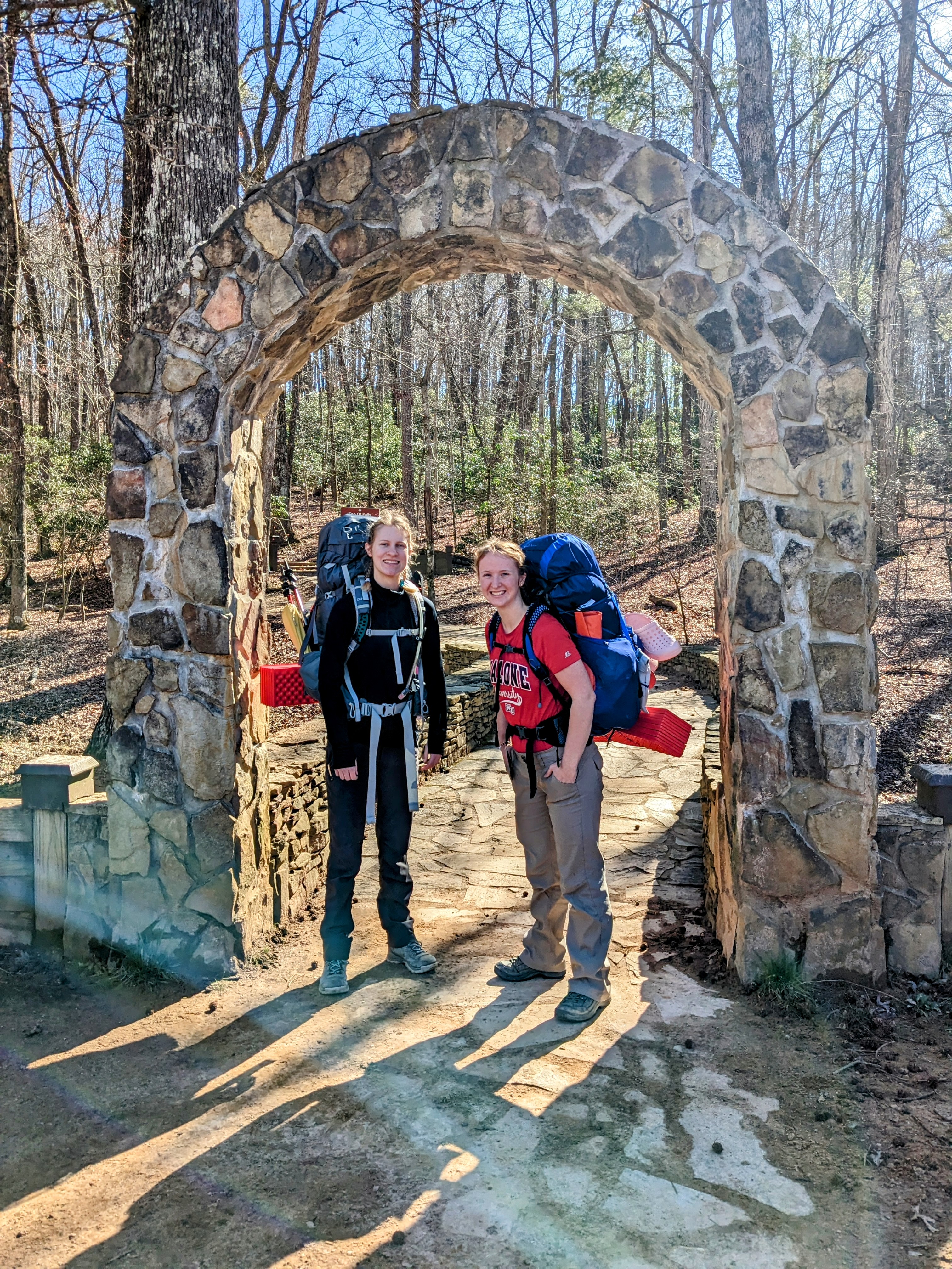
After a quick drive to Amacalola Falls, we dropped our packs under the pavilion and ate breakfast. I handled a couple phone calls and then we headed to the hiker registration to get our hang tags and official numbers. I’m hiker #596 and Sami is #597. That means 595 hikers have started before us and there’s even more coming after us!
We put our hang tags on our backpacks, showing our intentions to hike the whole thing, and they pointed us down to the arches at the beginning of the Approach Trail.

The AT doesn’t start down at the park. It begins on Springer Mountain. As such, you can either drive or hike to the summit to begin your journey. We opted to hike.
The Approach Trail starts with a 601-step climb up past Amacalola Falls. Any time you do steps, it’s rough. But 601 steps with a full backpack is something else entirely. However, anytime we paused, the glorious falls were there for us to admire. The steps were also full of day hikers, who encouraged us the entire way up. At the top of the falls, we stopped for lunch.

Those of you who have hiked with me before know: my body absolutely rejects food on the first day or so of a hike. I’ve never understood it, never been able to figure out why, never been able to solve it. However, we brought pretzels from the train and Church Mouse handed me a portion that “you have to eat” and for the first time in several trips, I was able to eat on the first day without being repulsed. I didn’t necessarily eat a lot, but the blessing of being able to eat even a little bit without convincing my body that every bite was necessary was incredible.
After this brief stop, our legs recovered from all those steps and it was time to keep going. We’d gotten a later start than what we would have liked that morning and there was still 7.5 miles to do before dark.
Once we walked away from the falls, the number of day hikers we saw dropped dramatically. Instead, everyone we ran into were thru-hikers, including a southbound hiker finishing his thru-hike! At one place, mom stopped to let out her husband and daughter and when we came by, she topped off our water for us. We were then able to give some water to other people who needed it. We also had extra snacks from the train that I was carrying and so we did try to pawn some off on whoever we passed who were sitting and looked like they could use something to eat.
At one point, halfway up to Springer, we stopped and looked around at the mountain range surrounding us. The sun was brilliant, we were wearing tshirts in February, a perfect, light breeze danced through the trees. The mountains were fading into each other in the distance, different shades of blue and gray framed against the horizon. “This is our home for the next five months,” I whispered.

We finally made it to the first shelter, a mile below Springer. Despite the training we’ve attempted to do in Ohio, it doesn’t really prepare you for the long ups and downs of a mountain. We were both tired and sore, and stopped for a quick breather. The sun was getting a bit low, but both our goals was to make it to Springer on the first day.
The last mile of a hike is always the worst. My limited amount of food for the day was catching up to me hard, my hips burned, Church Mouse’s back ached. But Springer was right there, so close. Down at basecamp, one of the rangers gave us this advice: “You’re not hiking to Katahdin. You’re hiking to the end of the day. And then to the end of the next day and the next day.” And so we kept going.
Finally, we stumbled out into a clearing and saw, clearly, for the first time, a white blaze.

I’d often wondered what it would be like to be on Springer for the first time, starting this journey I’d wanted to do for so long. Would I cry? Laugh? What would my emotions be?
In reality: exhaustion. We both dropped our packs instantly, and I sprawled out on the ground next to the first blaze. “We made it,” I gasped to Church Mouse. She simply nodded back, already eating another snack. (Her body has no qualms about eating on the first day; she was managing much better than me.)
We stayed there for a bit, letting the weariness fade under the warm, Georgia sun. When our bodies felt like moving again, we took pictures with the blaze (with the sun staring us straight in the eyes) and signed the logbook.
Springer Mountain Shelter was only .2 miles away, so we picked our packs back up again and headed there to make our first camp on the A.T. We set up our tent, made some dinner, and promptly crawled into bed.

These are the first steps of our journey. Tomorrow we get to wake up to another beautiful day and hike our next miles. Katahdin, here we come.
Leave a Reply