When I first started hiking the Appalachian Trail, I had no intention of doing more after that. One thru hike was enough for me, thank you very much. Who needed to walk that much in one life anyways?
But see, here’s the thing. When you’ve spent one night, and then one week, and then one month operating out of your backpack, throwing out your tent wherever you feel like sleeping, watching the stars pass you overhead, living in the sunshine day in and day out, you realize that maybe doing another long trail wouldn’t actually be that bad.
So when things started falling into place for me to tackle another long trail, who was I to say no?
Introducing the Continental Divide Trail

It’s ~3,100 rugged miles of trail through the heart of America. I’m hiking the trail southbound (or in thru hiker terms: SOBO), meaning that I’ll start at Chief Mountain, in Glacier National Park, and hike south along the Continental Divide, finally ending at the Crazy Cook Monument at the Mexican/New Mexican border.
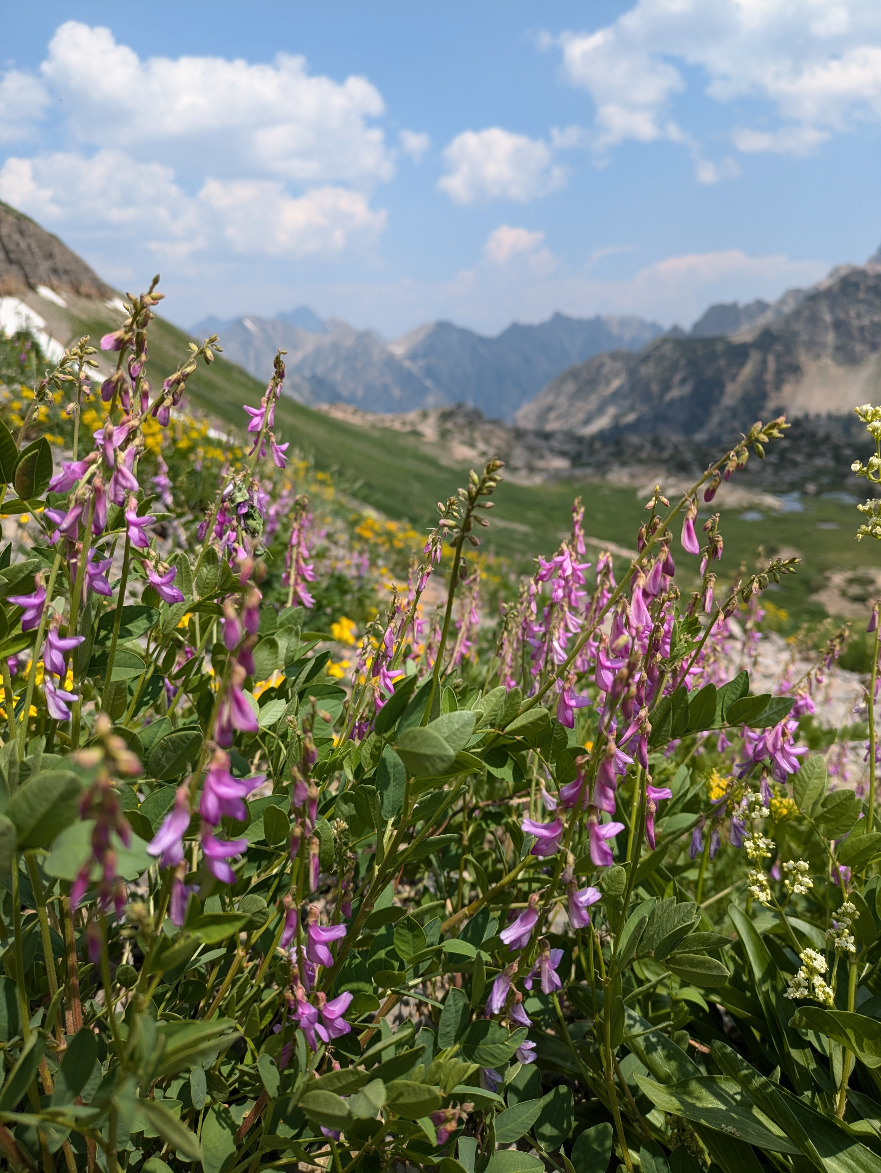
I’ll pass through the incredible Rockies, the diversity of Yellowstone, deserts, high alpine passes, dense forests, wide open plains, and everything in between.
While I’ve done some hiking out west before (looking at you, Grand Tetons), most of this trip will be entirely new experiences for me: snowpacks, high elevation, desert, long water hauls, plains. But that’s what makes it an adventure!
What this looks like
While thru hiking is notoriously hard to plan out, here’s a basic overview of what it will look like this summer. (Wall-sized maps can be found here.)
Montana
Miles: ~800
Highlights: Starting this amazing journey in Glacier National Park!!; being in Montana?!?
Challenges: Snowpacks, even though I’m starting in June; permits for Glacier
Idaho/Montana border
Miles: ~300
Highlights: Bitterroot Mountains; wild ridgeline walking
Challenges: Sparse resupply options
Wyoming
Miles: ~550
Highlights: Yellowstone National Park (I’m so excited to backpack through here); Wind River Reservation
Challenges: Long water hauls; mosquitos (bane to all who have blood)
Colorado
Miles: ~740
Highlights: Rocky Mountain National Park; the San Juans; the highest point on trail (14,278 ft!!!); aspens turning golden during fall
Challenges: High altitude and steep elevation gain/loss; must be through the San Juans by mid-September or there’s risk of getting snowed out
New Mexico
Miles: ~800
Highlights: Gila River alternative (I’ve heard so many good things about this!); Crazy Cook Monument—the finishing point!
Challenges: Sand everywhere (or so I imagine it right now); unreliable water sources; navigation in the desert
How is the CDT different from the AT?
One of the most common questions I see is, how is it going to be different from your first thru hike? Well, here you go: It’s going to be a lot longer, a lot more wild, and with much higher elevation.
| Continental Divide Trail | Appalachian Trail | |
|---|---|---|
| Length | ~3,100 miles | ~2,200 miles |
| States | MT, ID, WY, CO, NM; follows the Continental Divide | GA to ME; Follows the Appalachian Mountain range |
| Navigation | Less marked, requires GPS/maps; many alternates | Well-marked with white blazes; easy to follow; very few alternates |
| Elevation | ~4,000 to 14,000+ ft (Colorado) | ~400 to 6,600 ft (Clingmans Dome) |
| Weather | Dry deserts, snowfields, alpine storms, wide range | Humid, rainy, potential snow early/late season |
| Resupply | Fewer and farther between; requires planning | Frequent (towns every 3–5 days) |
| Water | Often scarce, especially in NM and WY | Abundant (except PA during a drought) |
| Trail Community | Sparse, independent hikers | Vibrant trail culture: hostels, trail angels, trail magic, social |
| Wilderness Feel | Remote, wild, solitude | More developed, frequent road and town crossings |
| Wildlife | Grizzlies, moose, wolves, mountain lions | Black bears, deer, snakes, porcupines |
| Typical Timeframe | 4.5–6 months | 4.5–7 months (I did it in 5.5 months) |
| Popularity | ~300–500 attempt/year | ~3,000+ attempt/year |
What am I least looking forward to?
Hands down, being so far away from all of my people. I know the adventure will be incredible, but it’s going to be difficult to not have anyone to share the adventure with.
And irrationally: Vermont. I know I’m not hiking in Vermont and that the weather will be completely different, but I still can’t think about thru hiking without picturing Vermont’s mud and rain. Every time I do, I think my soul dies a little bit inside. It’s an irrational fear, I get it, but we’re going hiking despite it.
What am I most worried about?
Injury. I’ve seen how fast it can sneak up on people and take them out. I watched it take multiple people out on the AT, and I’m worried that I’ll end up out there and find myself having to come home early because of an overuse injury.
What am I most looking forward to?
Being outside again. Mountains. Wildflowers blooming around me. Looking back and seeing how far I’ve walked. The personal accomplishments that I can find in the day-to-day. Wildflowers. (I know, I know; I said that twice, but I really love flowers.)
No matter what happens on this trip, I know it’s going to be an incredible adventure.
Ways to be a trail angel

A hike like this doesn’t happen without the backing of a community. Thank you for all the ways you’ve made this possible for me, through your encouragement, support, and enthusiasm!
If you’d like to do a little bit of trail magic for me, here’s some easy ways:
- Read my blog posts and leave a comment!
- Share a post with someone else you think would enjoy it.
- Add a song recommendation to my Spotify playlist
- Donate towards a resupply (venmo: @Daleen-Cowgar).
Leave a Reply